From the archives: Mohale Dam
11 October 2014 | rusty1052
Mohale Dam
Every day in Lesotho brings us something different. As a last minute suggestion on Friday some of the Lesotho Planners said they were interested in a trip to Mohale Dam on the eastern border of the Maseru district.
The dimension of learning, [apart from the lovely drive up and down to a height of 2,200 metres through hairpin bends and stunning countryside] would be to see the GPS devices capture altitudes as well as locations. Everywhere we go in Lesotho we are capturing points is what we are doing, as the country has relatively little of its features on maps. The data capture on the way up shows the hairpin bends as the GPS unit was set to capture our journey ar regular intervals.
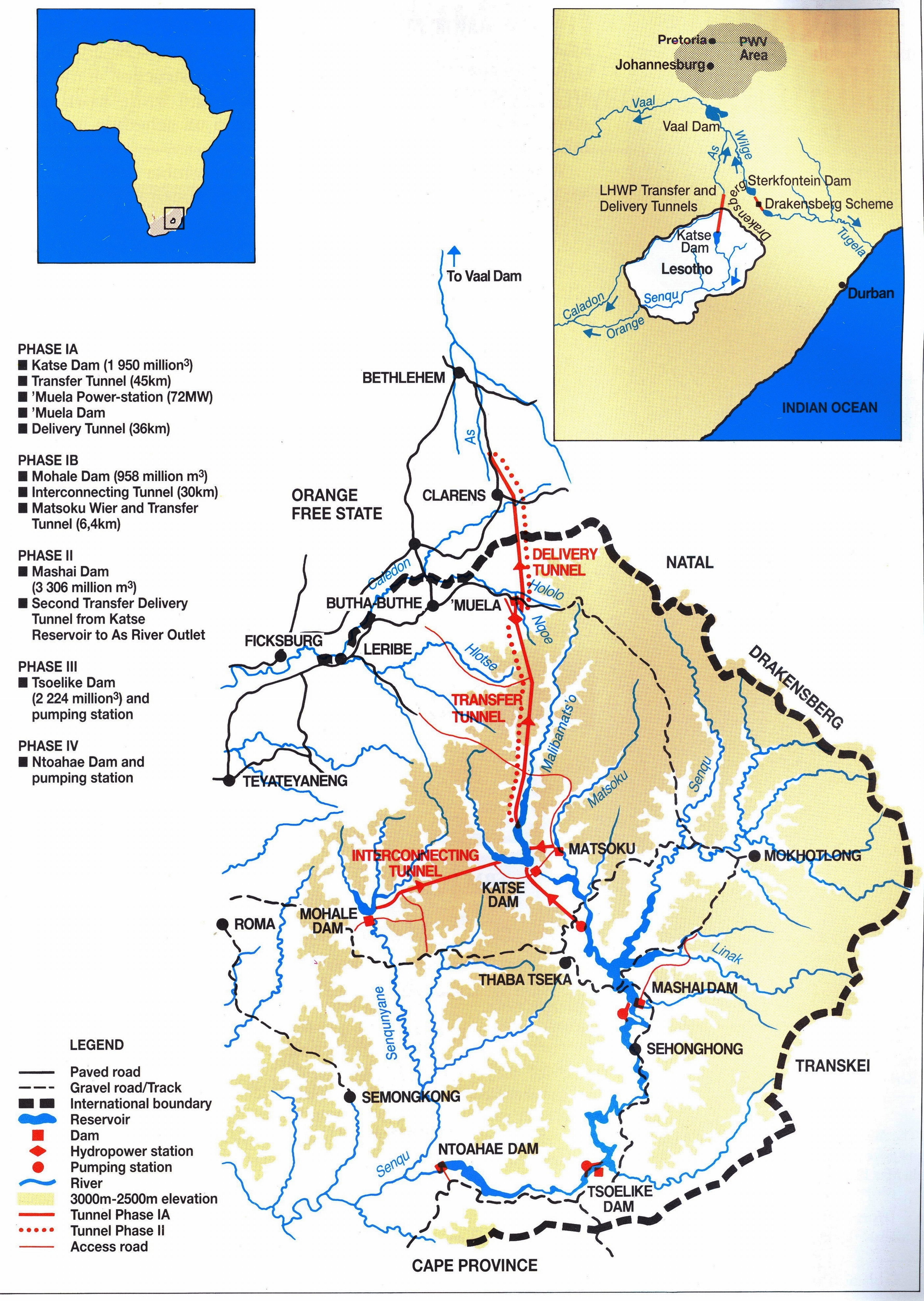
Back to the Dam. It certainly is an impressive structure, standing 145m tall and 620m across the valley through which the Senqunye River. It is constructed mainly from compacted rock and not from cast concrete. We received an orientation talk from the Highlands Development Authority on the history of the project at their visitor centre.
 @CiaranStaunton on TwitterLook, everything is postmodern now so nobody has any original ideas anymore. My views are therefore yours. Public servant, father, coach and obsessive.